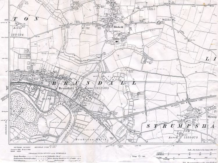
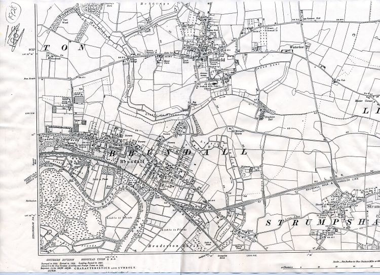
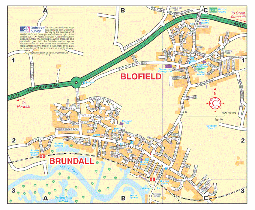
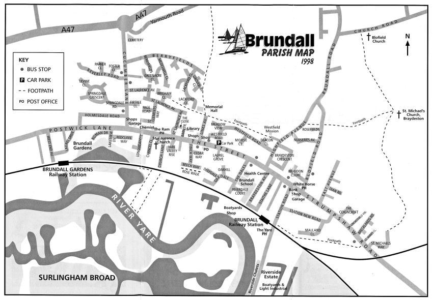
Brundall Local History Group
  • Home
  • Events
  • About
  • Archive
  • Learning
    • Edwardian Brundall
    • VE Day memories
    • Brundall Memories
    • Brundall Safari
    • Street names
  • Shop
  • Railway
  • Blooming Brundall
  • Churches Chapels
  • Brundall Buildings
  • Walk Brundall
  • River Yare
  • Brundall At War
  • Brundall Gardens
  • Snippets
  • Maps
  • Chronicle
  • Links
  • Cantley Sugar
Picture

Maps
A different view of our village

Scroll over to see caption, and click to view larger image.
In 1946, after World War 2, things started to happen
If you can enlarge this map enough you can see the date is 2007.  The large estate off Cucumber Lane
called 'Berryfields' is shown.  Brundall is separated from Blofield by the stream called the Lackford Run,
not shown on this map, which goes under the road between Highfield Avenue and Brundall Road.
A 2021 map
Copyright: Nothing on this website may be copied or published without the permission of the Brundall Local History Group. This does not mean we will not give permission, but you do have to ask us. The archive material has come from many sources and there are many copyright holders.
Powered by Create your own unique website with customizable templates.
  • Home
  • Events
  • About
  • Archive
  • Learning
    • Edwardian Brundall
    • VE Day memories
    • Brundall Memories
    • Brundall Safari
    • Street names
  • Shop
  • Railway
  • Blooming Brundall
  • Churches Chapels
  • Brundall Buildings
  • Walk Brundall
  • River Yare
  • Brundall At War
  • Brundall Gardens
  • Snippets
  • Maps
  • Chronicle
  • Links
  • Cantley Sugar